A Coastline That Grows Almost Twelve Times Longer
Skip the fjords and Norway's coastline is about 2,500 km long. Now follow every turn into its nearly 1,200 fjords, and the estimate jumps to around 29,000 km. That huge gap is an extreme example of the coastline paradox, and fjords are the reason it gets so wild.
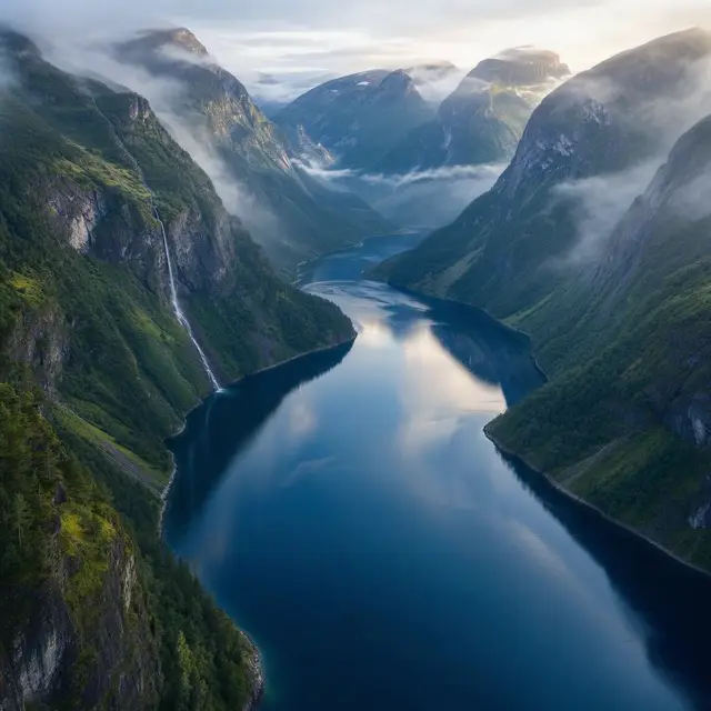
A fjord is a long, fairly narrow arm of the sea with steep sides or cliffs. It sits in a valley that a glacier once carved, and the sea flooded it after the ice was gone. Fjords line the coasts of Antarctica, the Arctic and the lands around them, in both the northern and southern hemispheres.
The word comes from Norwegian, and it is one of the few English words that start with the letters fj. For a long time it was usually spelled fiord. That spelling now survives mostly in New Zealand English, as in the region called Fiordland.
Carved by Ice, Deeper Than the Sea
A fjord starts life as a valley with a gently sloping floor. Then a glacier moves in and grinds away the bedrock, leaving a deep U-shaped valley that ends abruptly. When the ice melts and the ocean pours in, you have a fjord. Most fjords end up deeper than the sea next to them. Norway's Sognefjord reaches as much as 1,300 m below sea level.
Near the coast, the glacier spread out and lost its cutting power. So many fjords have a rocky sill across the entrance. These ridges can cause extreme currents and big saltwater rapids. Saltstraumen in Norway is often described as the world's strongest tidal current.
As the heavy ice disappears, the land slowly lifts back up, a process called glacial rebound. In the 19th century, Jens Esmark argued that glaciers made fjords. John Walter Gregory later claimed they came from movements of the Earth's crust instead, but later research rejected his view.
Waterfalls From Hanging Valleys and Water in Layers
Fjord walls often hold a strange feature called a hanging valley. It is a side valley that sits higher than the main one, because a smaller glacier once flowed into a much bigger one. The side valley seems to hang above the fjord, and waterfalls often pour from its edge. Some of these small waterfalls are even used as sources of fresh water.
Hanging valleys exist underwater too. The mouth of Ikjefjord is only 50 m deep, while the main fjord at the same point is around 1,300 m deep.
The water inside a fjord sits in layers. In summer, rivers pour in fresh water that mixes into a layer of brackish water on top, while cold, salty water from winter stays still below. Bolstadfjorden has a sill only 1.5 m deep, and its brackish surface blocks the deep water from mixing. Its deep, salty layers run short of oxygen, and in fjords like this, the deep water can become unsuitable for fish.
Coral Reefs in Total Darkness
In 2000, coral reefs were discovered along the bottoms of Norwegian fjords, from the north of the country to the south. These reefs host thousands of lifeforms, including plankton, anemones, fish and several species of shark. Most of them are adapted to heavy water pressure and the total darkness of the deep. The reefs are believed to be one of the main reasons the Norwegian coast is such a rich fishing ground.
New Zealand's fjords have deep-water corals too. There, a dark layer of fresh water on the surface lets them grow in much shallower water than usual. An underwater observatory in Milford Sound lets tourists see them without diving.
Near the open sea, ice-scoured channels can break the coast into thousands of rocky islands and reefs. Each one is called a skerry, from the Old Norse word sker, meaning a rock in the sea. Behind Norway's skerries, a sheltered channel covers almost the entire 1,601 km route from Stavanger to North Cape.
Fake Fjords, Lake Fjords and a Lake That Turned Salty
Not every place called a fjord really is one. Many steep inlets with the name are actually a ria, a river valley drowned by the sea. Saco do Mamanguá in Brazil has been labeled the world's only tropical fjord, and the rocky inlets of Acapulco, where cliff divers perform daily, are called fjords in the city's tourist literature.
Norway goes the other way. Long, deep lakes carved by glaciers often carry fjord names too. Locals call Mjøsa, the country's largest lake, simply the fjord. Hornindalsvatnet is at least 500 m deep, and water takes an average of 16 years to flow through it.
One lake even switched sides. Movatnet was a freshwater lake until a flood in November 1743 wore away its river bed and let sea water flow in at high tide. It became a saltwater fjord and was renamed Mofjorden. Today, Norway's heritage fjords plan to require visiting ships to be zero-emission by 2032.