What Is Left When Lakes Dry Up
Salar de Uyuni sits in southwestern Bolivia, high on the altiplano near the crest of the Andes at 3,656 metres above sea level. It covers roughly 10,582 square kilometres, which makes it the largest salt flat in the world.
It is the leftover of water that is no longer there. Seven lakes occupied this basin during the late Pleistocene, and as each one dried, it left its dissolved minerals behind. What remains is a crust of salt about eight metres thick, sitting on top of a pool of brine.
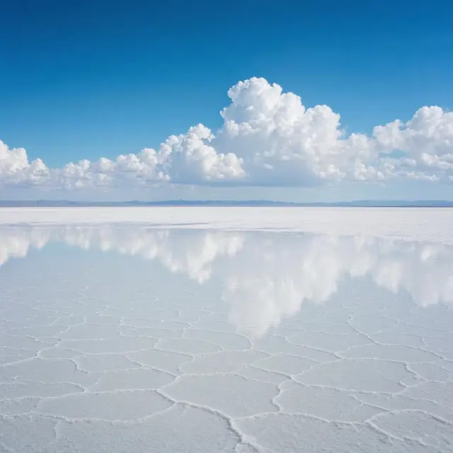
The flatness is the remarkable part. Across that entire area, the surface varies in height by less than one metre. Nothing else on land comes close. After rain, a thin film of perfectly still water sits on the crust and turns the whole place into a mirror 129 kilometres wide, reflecting the sky so completely that the horizon disappears.
A Ruler for Satellites
That flatness has a practical use. Space agencies calibrate satellites against the salar, because it gives them something enormous, even and predictable to measure.
Two qualities matter. The surface has very high albedo, meaning it bounces back most of the sunlight that lands on it, and it is uniform across thousands of square kilometres. Add stable conditions and very little radio interference at that altitude, and you have a target roughly five times more useful for calibration than the open ocean.
The list of missions that have used it is long. In September 2002, NASA ran extensive GPS surveys across the salar to help calibrate the laser altimeters of its ICESat-2 mission down to centimetre accuracy. The Landsat-5 satellite had its Thematic Mapper calibrated in flight against the same surface. Europe's Sentinel-1A surveyed it weeks after launch in 2014, and the CryoSat-2 ice mission has relied on it too.
Salt on Top, Lithium Underneath
The salar holds an estimated 10 billion tonnes of salt, of which less than 25,000 tonnes is taken out each year. All the miners working there belong to a single cooperative based in the village of Colchani.
The more valuable material is below. The salar sits inside the region known as the Lithium Triangle, and the brine under the crust carries lithium at a concentration of about 0.3 percent, along with sodium, potassium, magnesium and borax. As of 2024, Bolivia held roughly 22 percent of the world's known lithium resources, most of it here.
Getting it out has proved harder than the numbers suggest. The lithium comes with more impurities than elsewhere, and the wet season and high altitude complicate processing. Extraction attempts by foreign companies in the 1980s and 1990s met strong local opposition, since people doubted the money would ever reach them. There is still no mining plant on the site.
Hotels Made of Salt, and Flamingos
Tourism runs on the strangeness of the place. With no ordinary building materials nearby, several hotels have been built out of blocks cut from the flat itself: walls, roof and furniture all salt. The first, Palacio de Sal, went up between 1993 and 1995 in the middle of the flat and became popular fast, but its location caused serious waste problems and it was taken apart in 2002. A replacement opened around 2007 at the eastern edge, with a proper sanitary system.
Three kilometres outside the town of Uyuni sits an antique train cemetery. British engineers built the rail lines here between 1888 and 1892 to carry minerals toward Pacific ports. When the mining industry collapsed in the 1940s, the trains were simply left where they stood.
The flat itself is nearly lifeless, but every November three species of flamingo arrive to breed, feeding on the brine shrimp. On the rocky islands, giant cacti grow about a centimetre a year, reaching 12 metres.